Equipment
We offer high-precision equipment of our own production for various applications.
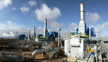
Engineering surveys for complex process facilities in our time are impossible without the using of laser scanning technology
Topographic maps and plans serve as the basis for the design, construction and reconstruction of capital constructions, creating of geoinformation systems (GIS), integrated engineering and economic assessment, management and operation.
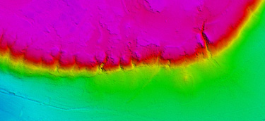
Airborne and mobile laser scanning is used to collect geospatial information about the terrain to solve problems of mapping large, lengthy, including hard-to-reach areas such as mountains, forests or wetlands.
The results of laser scanning data processing can be digital topographic maps and plans, digital elevation models, digital terrain models, orthophotomaps, various raster geospatial models and other derived materials in different coordinate systems. The AGM Systems LLC offers technical and software tools covering the entire process of creating cartographic products, from fieldwork to the production of final materials.
We offer high-precision equipment of our own production for various applications.
Our software allows to effectively process large volumes of remote sensing data.
We offer to our customers the complete production workflow.