AGM Topoplan
Software for creating digital topographic maps in the Autodesk AutoCAD environment.
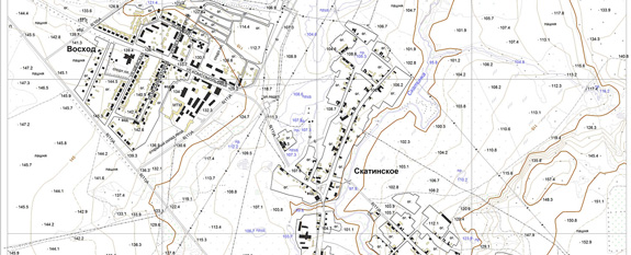
AGM Topoplan is designed to create digital terrain models, engineering-topographic maps of a scale range of 1: 500-1: 5000 and maps of scale 1:10 000 for using in cadastral and land management, engineering surveys for construction, executive surveys and design.
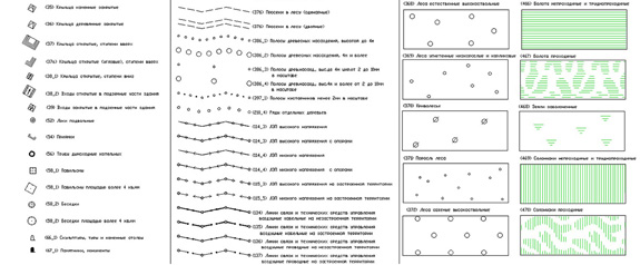
The program is compatible with all versions of Autodesk AutoCAD 2010 - 2016, contains a complete library of topographic signs (according to the collection of "Symbols for topographic plans of scales 1: 5000, 1: 2000, 1: 1000, 1: 500", approved by GUSK 25.11.1986. and "Symbols for a topographic map of scale 1: 10000", approved by GUSP 1977, with temporary amendments and additions introduced by Roskartografiya order of 20.03.2001).
The library of symbols is complete in accordance with the current regulatory and technical documentation.
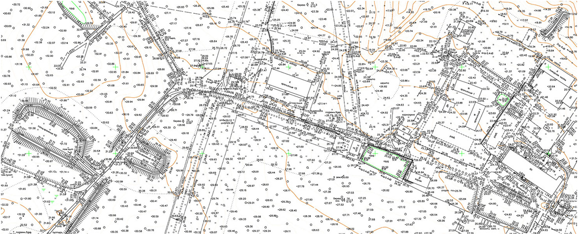
АГМ Топоплан совместим с остальными продуктами компании "АГМ Системы" и может использоваться для создания цифровой картографической продукции по данным мобильного лазерного сканирования с использованием АГМ Паноскан с возможность оцифровки по панорамным снимкам и привязкой к лазерным точкам.
Использование всего комплекса программных продуктов и оборудования нашей компании делает работу по векторизации быстрой и удобной, что позволяет обрабатывать в короткие сроки большие объемы полевых измерений.